iStar (i) An interactive star coordinates approach for high-dimensional data exploration
Abstract
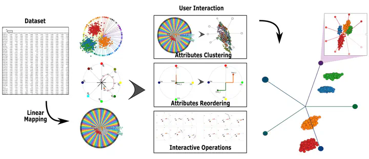
Star Coordinates is an important visualization method able to reveal patterns and groups from multidimensional data while still showing the impact of data attributes in the formation of such patterns and groups. Despite its usefulness, Star Coordinates bears limitations that impair its use in several scenarios. For instance, when the number of data dimensions is high, the resulting visualization becomes cluttered, hampering the joint analysis of attribute importance and group/pattern formation. In this paper, we propose a novel method that renders Star Coordinates a feasible alternative to analyze high-dimensional data. The proposed method relies on a clustering mechanism to group attributes in order to mitigate visual clutter. Clustering can be performed automatically as well as interactively, allowing the analysis of how particular groups of attributes impact on the radial layout, thus assisting users in the understanding of data. The effectiveness of our approach is shown through a set of experiments and case studies, which attest its usefulness in practical applications.
Germain Garcia-Zanabria
Computer Scientist | Data Scientist | Researcher
My areas of interest are data visualization, visual analytics, machine learning, data science, crime analysis, crime prediction, dropout analysis, geo-referenced data, Spatiotemporal analysis, and computer science for social goods.